


Hbt Bois carre

Lamartiniere
User GUIDE

Length
3.7 km

Max alt
53 m

Uphill gradient
66 m
Km-Effort
4.7 km

Min alt
9 m

Downhill gradient
82 m
Boucle
No
Creation date :
2023-03-06 17:37:30.879
Updated on :
2023-03-06 20:47:05.808
1h48
Difficulty : Easy

FREE GPS app for hiking
 SityTrail
IGN / Geographical institutes
SityTrail Plus
The world is yours!
About
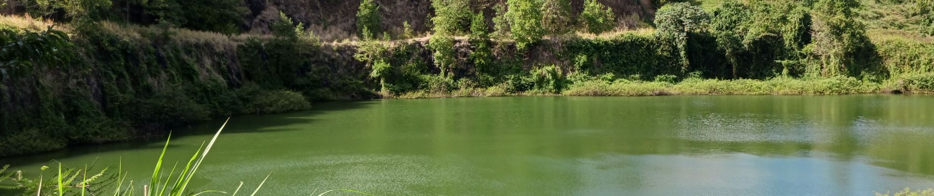
Trail Walking of 3.7 km to be discovered at Martinique, Unknown, Le Lamentin. This trail is proposed by Lamartiniere.
Photos


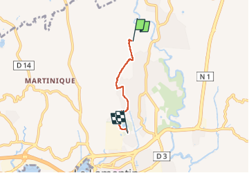
Positioning
Country:
France
Region :
Martinique
Department/Province :
Unknown
Municipality :
Le Lamentin
Location:
Unknown
Start:(Dec)
Start:(UTM)
715939 ; 1620170 (20P) N.
Comments